Rossendale Vistas
Rossendale
734 metres climb
Risk assessed route
Distance - 26.9 miles
Bike suitability - Mountain Bike, Hybrid (off road tyres), Hybrid (road tyres), Road
Route rating
(13 reviews) About the route
Starting point
The Picnic Site, Whitaker Park
Haslingden Road
Rossendale
Lancashire
BB4 6RE
Whitaker Park
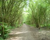
Starting in the heart of the Rossendale valley at Whittaker Park, situated between the famous Rossendale Ski Slope and the end of the East Lancashire Railway this rolling route gives glorious vistas of the valley including Cowpe Lowe and Scout Moor and the various windfarms scattered over the local hills.
A foray into part of Greater Manchester sees a visit to Turton Tower with the chance for coffee and cake before a climb back towards the valley and another chance to see the beauty that Rossendale has to offer.